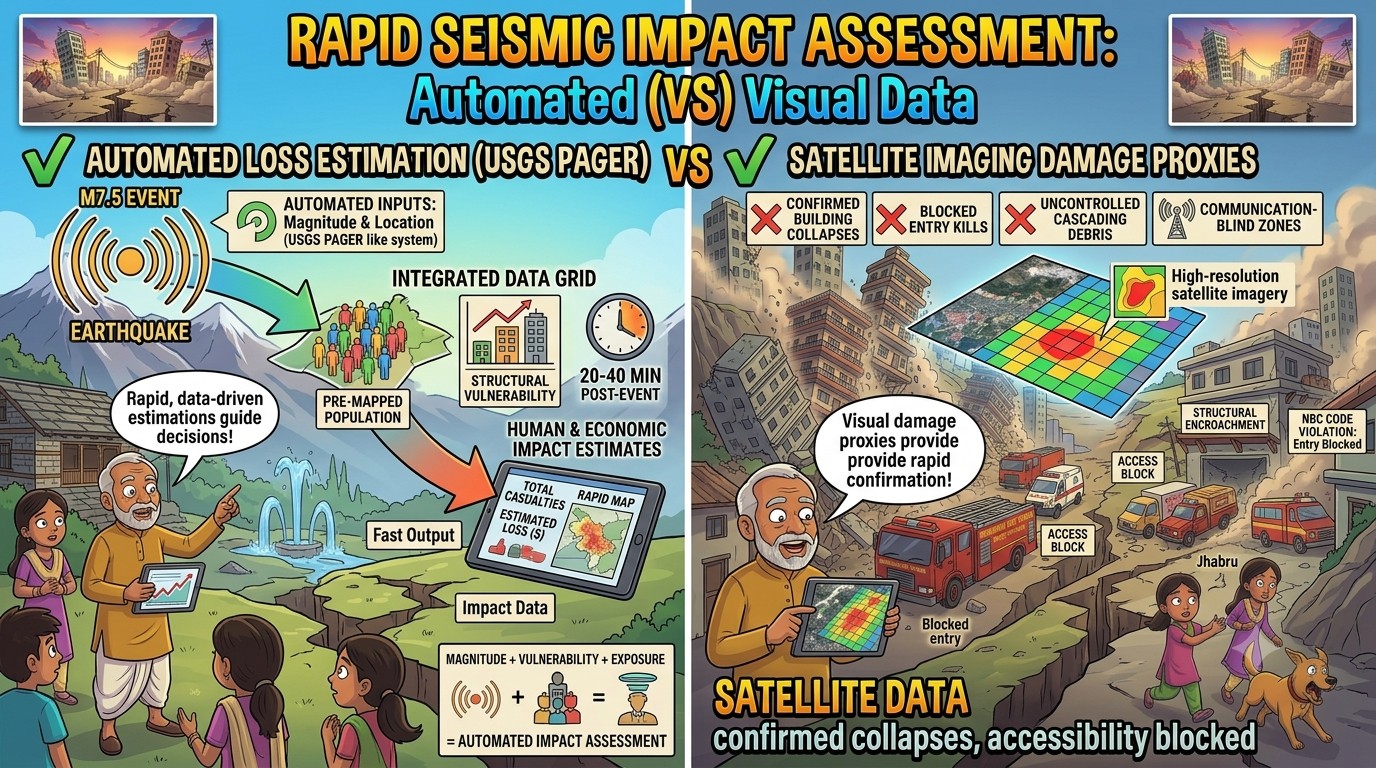
 Santa was sitting in his local Civil Defence office, looking at an automated system alert that had flashed onto his central monitor just twenty minutes after a severe earthquake hit a neighbouring district.
The alert screen showed a color-coded map of the region, flanked by red and yellow bar charts estimating projected human casualties and economic losses.
“Oye Banta, look at this sorcery!” Santa yelled, pointing his finger at the monitor.
“The rescue teams haven’t even arrived at the scene, and this software is already estimating that between one hundred and five hundred buildings have collapsed!”
“It’s calculating population exposure and vulnerability indices!”
“How can a machine know the loss before seeing the rubble?”
Banta sat down at the terminal, opening a live satellite telemetry window that overlaid high-resolution radar and optical imagery over the color-coded map.
“This isn’t sorcery, Santa-ji; this is the PAGER (Prompt Assessment of Global Earthquakes for Response) methodology combined with satellite damage proxies.”
“PAGER?”
“Banta, that sounds like an old 1990s beeper pocket device!”
“How does it read the ruins?” Santa asked, leaning closer.
“It reads the numbers before the disaster happens, Santa,” Banta explained, zooming into a high-density zone on the map.
“The moment a quake is detected, the automated system takes the magnitude, depth, and location, and instantly drops it onto a pre-mapped database of local geology and population exposure data.”
“It knows exactly how many people live in that zone, what types of unreinforced masonry structures they occupy, and how vulnerable those buildings are to shaking.”
“Within 20 to 40 minutes, it generates an automated loss estimation matrix to tell international and national response agencies the scale of the emergency!”
Santa shook his head in disbelief.
“But Banta, what if the structural estimation is wrong?”
“A model is just a guess on a screen!”
“That is where the second layer steps in, Santa,” Banta said, clicking open the satellite tab.
“We pair the automated PAGER estimate with high-resolution post-event satellite radar imagery.”
“By comparing the pre-disaster building footprints with the post-event surface roughness data, the system flags exact building collapse zones from space!”
“We don’t have to wait for broken communication lines to tell us where the crisis is.”
“This automated data allows our National Disaster Response Force (NDRF) to move straight to the hardest-hit high-intensity zones with targeted medical aid, bypassing low-impact areas completely!”
“It moves our strategy from blind reaction to precision mitigation.”
Santa watched the satellite proxy map highlight a remote valley sector in deep crimson.
“Oye… so the technology looks through the clouds to find our broken roofs before we can even clear the roads?”
“Exactly, Santa-ji,” Banta said.
“When you combine demographic exposure models with space-borne data, you save the lives that are ticking away under the concrete.”
संता – बंता की इस जुगलबन्दी से आज हमने क्या सीखा:-
- स्वचालित क्षति आकलन प्रणालियां / Automated Loss Estimation Systems:
- USGS PAGER जैसी प्रणालियां भूकंप के परिमाण और स्थान को पहले से तैयार जनसंख्या घनत्व और ढांचागत घातकता सूचकांकों (vulnerability indices) के साथ जोड़कर आपदा के 20 से 40 मिनट के भीतर मानव और आर्थिक नुकसान का सटीक अनुमान लगाती हैं / Systems like USGS PAGER combine magnitude and location models with pre-mapped population exposure and structural vulnerability indices to estimate human and economic impacts within 20 to 40 minutes of a seismic event.
- उपग्रह इमेजिंग क्षति संकेतक / Satellite Imagery Damage Proxies:
- आपदा के बाद हाई- रेसोलुशन ऑप्टिकल और रडार सैटेलाइट इमेजरी को एकीकृत करने से ढांचागत नुकसान के तत्काल संकेतक (damage proxies) मिलते हैं, जिससे संचार-विहीन क्षेत्रों में भी इमारतों के ढहने की पुष्टि की जा सकती है / Integrating high-resolution optical and radar satellite imagery post-event provides rapid structural damage proxies, allowing disaster management agencies to confirm building collapses in inaccessible or communication-blind zones.
संता – बंता की यह जुगलबन्दी आपको कैसी लगी, कृपया हमें जरुर बताये
व
इस जुगलबन्दी को बेहतर बनाने के लिये अपने सुझाव अवश्य दें।
हमें हमेशा की तरह आपके सुझावों, प्रतिक्रियाओं व कटाक्षो का बेसब्री से इंतजार रहता हैं औरसच मानिये इसी के आधार पर हम अपने आप में, अपनी सोच व रचनात्मकता में सुधार करने कोप्रेरित होते हैं।
सो अच्छा – बुरा जैसा आपको महसूस हुवा हो, कमेंट जरुर करते रहें।
#PAGERModel#SatelliteDamageProxy #PopulationExposure #AutomatedAlerts #DisasterLogistics#SantaBantaStories
Leave a Reply