 The devastating flood of February 7, 2021, remains a landmark event in Himalayan disaster research. This was not a simple “glacier burst” or a singular GLOF. It was a cascading, multi-stage disaster triggered by a rock-ice avalanche that transformed into a massive liquid wall through sequential intermittent damming.
1. The Three-Stage Damming Mechanism
Unlike a typical flood, the 2021 disaster involved sequential intermittent damming at three distinct locations. This process explains how a massive volume of approximately 6 million cubic meters of water was mobilized during a dry winter season with no rainfall and minimal glacial melt.
-
Stage I: Raunthi Gadhera (The Origin): The avalanche of rock and ice from Ronti Peak first blocked the upper reaches of the Raunthi Gadhera. This created an initial reservoir of water and slurry.
-
Stage II: Rishiganga (The North Murunna Blockade): As the debris moved downstream, it dammed the main Rishiganga river north of Murunna. This second blockade was pivotal; it held back the main river’s discharge, which then combined with the Raunthi Gadhera surge.
-
Stage III: Dhauliganga (The Rini Blockade): Finally, the river was dammed again around Rini village, just upstream of the confluence of the Rishiganga and Dhauliganga rivers. When these sequential dams breached, the resulting energy was catastrophic.
2. The Permanent Rishiganga Lake
While the downstream floods were transient, the blockade on the Rishiganga was not entirely temporary.
-
Current Status: A landslide-dammed lake was formed approximately 500–700 meters upstream of the confluence of the Rishiganga and Raunthi Gadhera.
-
Longevity: Despite early efforts by the ITBP and SDRF to widen the outflow channel to 20 meters, this lake persists today. It remains a critical feature of the landscape, holding a significant volume of water behind a barrier of rock, debris, and embedded ice blocks.
3. The “Winter Paradox”: Why it was so Lethal
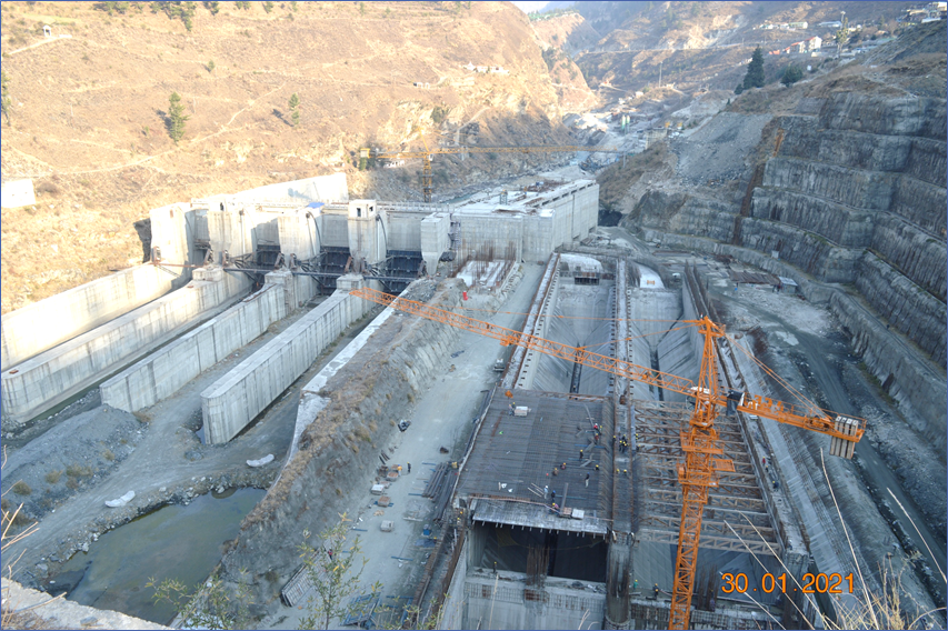
The disaster occurred when river discharge is at its annual minimum. This created a “False Sense of Security” for the workers at the Rishiganga (13.2 MW) and Tapovan (520 MW) projects.
-
Minimal Discharge: Because it was winter, the natural “buffer” of high water levels wasn’t there to alert the projects.
-
No Warning System: The lack of automated water-level sensors meant that even as the sequential dams were breaching upstream, the projects downstream had zero lead time.
4. Progress Since 2021: Beyond GLOF Monitoring
Because the 2021 event proved that “dry” peaks can become “liquid” disasters in minutes, Uttarakhand has moved toward Multi-Hazard Early Warning Systems (EWS).
-
Seismic-Acoustic Monitoring: Since an avalanche creates distinct ground vibrations before the flood arrives, institutes like WIHG and IIT Roorkee are experimenting with “Seismic Sentinels.” These sensors detect the “thud” of an avalanche, potentially providing a 2 to 5-minute lead time for downstream hydropower sites like Tapovan.
-
The NDMIS Digital Chain: Under the 16th Finance Commission’s new mandate, Uttarakhand is integrating real-time satellite feeds into the NDMIS Portal. This ensures that any “Artificial Lake” formation (like the one seen in 2021) is flagged by automated change-detection algorithms within hours, not days.
-
Aerial Drone Audits: The state now conducts seasonal drone surveys of the Raunthi Gad and other high-altitude tributaries. These “eyes in the sky” check for hanging glaciers that show signs of “cracking” or “sliding,” similar to the precursor movements seen years before the 2021 collapse.
5. The Persistent “Warning Gap”
Despite these scientific advances, your observation remains critical: Uttarakhand does not yet have a fully operational, automated end-to-end warning system.
-
The Connectivity Barrier: High-altitude regions still face “shadow zones” where satellite signals are blocked by steep ridges.
-
The “Human” Relay: Currently, the most reliable warning system remains the ITBP and SDRF patrols. In the absence of automated sirens, we rely on radio relays between high-altitude posts and district headquarters.
6. Financing the Future (16FC Allocation)
Uttarakhand’s ₹582 crore Mitigation Fund (SDMF) is a direct result of the 2021 tragedy. This funding is now being used to bridge the gap between “detecting” a hazard and “alerting” the last person in the valley.
| Initiative | Status | Goal (by 2031) |
| Doppler Weather Radars | 3 Installed |
100% Basin Coverage
|
| Village Sirens | Pilot Phase |
All “Red Zone” Villages
|
| Artificial Lake Monitoring | Satellite-Based |
Automated AI-Alerts
|
The devastating 2021 Rishiganga avalanche and the artificial debris dam it created warn us that the mountain can engineer its own destruction in seconds. These past events tell us that looking for ‘existing lakes’ is not enough; we must look at the ‘potential for collapse’ in every hanging glacier. Our ongoing initiatives in ‘Seismic-Acoustic Sentinels’ prove that we are finally listening to the mountain’s vibrations, but history warns us that if we do not turn those signals into automated downstream sirens today, the next avalanche will arrive before the warning can be spoken. Today tells us the peaks are fragile; it warns us that a ‘dry’ slope is only a few minutes away from becoming a liquid wall.
Leave a Reply