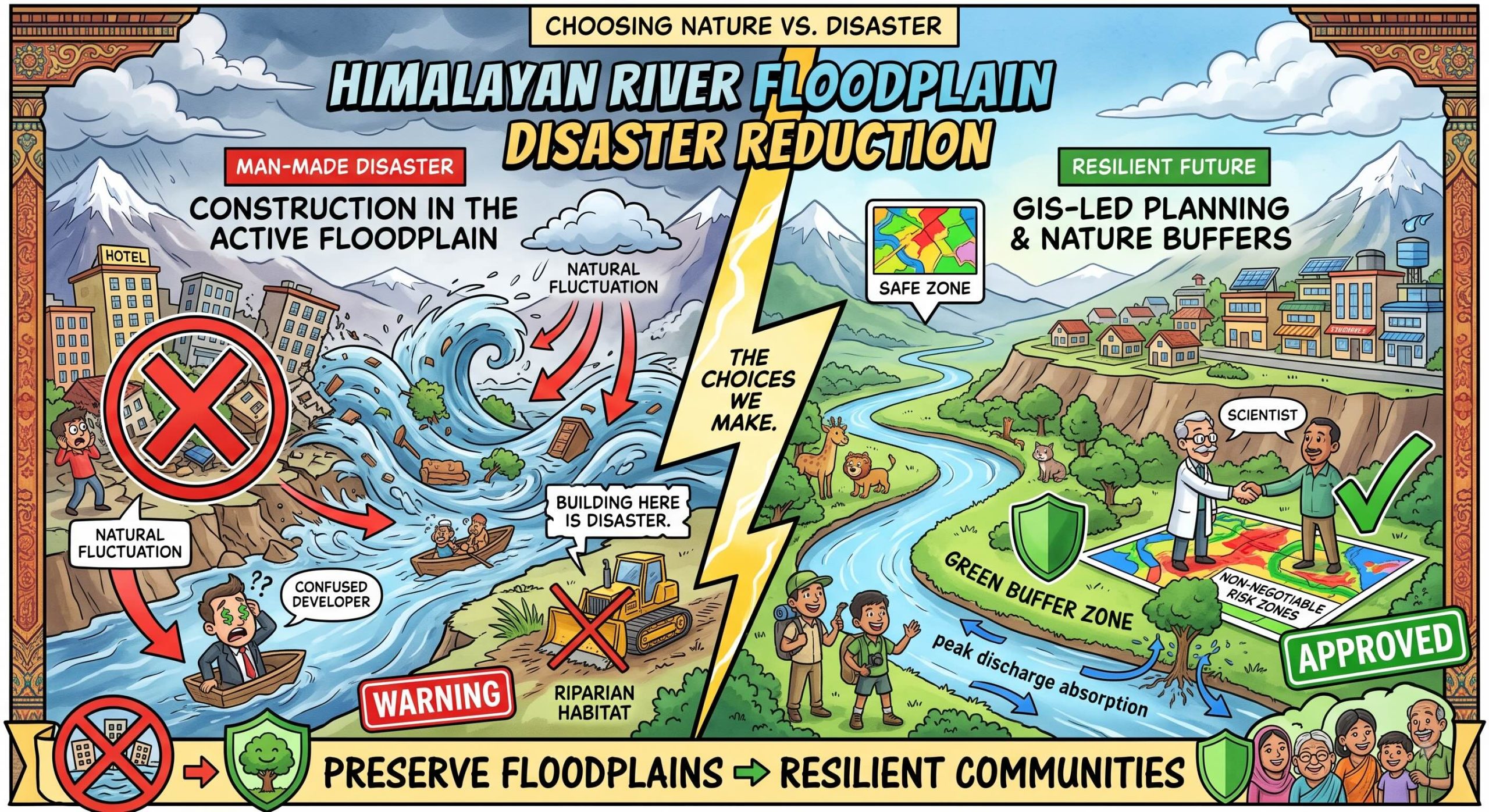
 Santa was working as a real estate developer, standing on a low-lying, flat gravel sandbar right inside the active seasonal floodplain zone of a major Himalayan river channel.
He was laying out bricks for a new, mass-market riverside commercial shopping hub and premium tourist homestay resort.
“Oye Banta, look at this geometric perfection!” Santa smiled, pointing to his row of foundations.
“This land was cheap, it’s flat, and tourists love stepping right out of their rooms into the river water!”
“This is high-yield tourism expansion!”
Banta walked onto the sandbar, carrying a tablet running a high-resolution GIS hazard zonation map generated via remote-sensing telemetry.
He pointed a red laser directly at the ground where Santa was standing—which sat squarely inside a bright purple zone labelled CRITICAL HAZARD ZONE: 100-YEAR FLASH FLOOD INUNDATION PATHWAY.
“Santa-ji, you aren’t building a luxury commercial hub; you are constructing a sand-castle inside a designated firing range!” Banta said seriously, showing him the tablet screen.
“You are completely ignoring high-resolution hazard maps and land-use risk zoning!”
Santa scoffed, throwing a brick into the mud.
“Oye Banta!”
“These maps are just theoretical computer graphics generated by office scientists in the capital!”
“This river hasn’t flooded this sandbar in ten years.”
“Why let a purple colour on a screen stop real economic growth?”
“The river doesn’t check your calendar before it reclaims its territory, Santa!” Banta countered, zooming into the historical footprint of the 2013 Uttarakhand floods and the 2021 Melamchi disaster.
“When extreme rainfall or an upstream landslide-dam breach occurs, the river channel expands to its full geomorphic capacity.”
“By constructing heavy concrete infrastructure directly inside the natural flood pathway, you turn a natural hazard into a man-made humanitarian disaster!”
“High-resolution hazard mapping using GIS and remote sensing isn’t an administrative option—it is a non-negotiable tool used to enforce land-use planning.”
“We must restrict unsafe development in these high-risk zones, preserve river floodplains as protective green buffers, and relocate critical structures to stable ground!”
“If you build inside the river’s home today, it will evict your entire investment tomorrow without a warning!”
Santa looked from the flashing purple inundation path on the tablet to the low water channel right next to his bricks, the historical reality of the flood footprints clearing his complacency.
He picked up his site plans and folded them up.
“Oye… so the computer graphic is just showing me the river’s actual boundaries when it gets angry?”
“Exactly, Santa-ji,” Banta smiled, guiding him back to the high terrace.
“Build on the solid heights that nature provided, and let the river basin breathe.”
संता – बंता की इस जुगलबन्दी से आज हमने क्या सीखा:-
- भू–उपयोग जोखिम क्षेत्रीकरण / The Critical Mandate for Land-Use Risk Zoning:
- नदियों के प्राकृतिक बाढ़ मैदान क्षेत्रों (floodplains) या बाढ़ मार्गों में व्यावसायिक या आवासीय संरचनाओं का निर्माण करना प्राकृतिक जल-चक्र को मानव-निर्मित आपदा में बदल सकता है। हाई-रिज़ॉल्यूशन जीआईएस (GIS) मानचित्रों के आधार पर किये गये भू-उपयोग नियोजन के माध्यम से इन क्षेत्रों में निर्माण पर पूर्ण प्रतिबंध होना चाहिये / Constructing commercial or residential assets within active river floodplains and designated inundation pathways turns natural hydrologic fluctuations into catastrophic man-made disasters. Land-use planning must enforce non-negotiable construction restrictions in high-risk zones using high-resolution GIS maps.
- पारिस्थितिकी तंत्र–आधारित अनुकूलन और बफर संरक्षण / Ecosystem-Based Adaptation and Buffer Preservation:
- नदी के किनारों और जलमार्गों को कंक्रीट के निर्माणों से पाटने के बजाय उन्हें प्राकृतिक हरित बफर (green buffers) के रूप में संरक्षित किया जाना चाहिये ताकि वे मौसमी बाढ़ के अत्यधिक पानी को सुरक्षित रूप से सोख सकें / Floodplains and riparian corridors must be preserved as natural, vegetated green buffers to absorb seasonal peak discharges, rather than being paved over for short-term tourism or real-estate development.
संता – बंता की यह जुगलबन्दी आपको कैसी लगी, कृपया हमें जरुर बताये
व
इस जुगलबन्दी को बेहतर बनाने के लिये अपने सुझाव अवश्य दें।
हमें हमेशा की तरह आपके सुझावों, प्रतिक्रियाओं व कटाक्षो का बेसब्री से इंतजार रहता हैं और सच मानिये इसी के आधार पर हम अपने आप में, अपनी सोच व रचनात्मकता में सुधार करने कोप्रेरित होते हैं।
सो अच्छा – बुरा जैसा आपको महसूस हुवा हो, कमेंट जरुर करते रहें।
#LandUseZoning #GISHazardMapping #FloodplainProtection#HimalayanFloodways #EcosystemAdaptation #SantaBantaStories
Leave a Reply