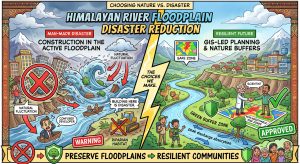
The Floodplain Fallacy: Why Building Near Himalayan Rivers is Financial Suicide: Santa lays out a premium riverside commercial resort right inside an active river flood channel, ignoring municipal restrictions. Banta uses a high-resolution GIS hazard zonation map to expose the geomorphic realities of the 2013 Uttarakhand and 2021 Melamchi disasters, explaining why land-use zoning is our only defense against man-made river tragedies.
Floodplain Zoning
Unravelling the 2025 Punjab Floods and Charting a Path to Resilience

The 2025 Punjab floods reveal a devastating truth: disasters are a hybrid of nature and neglect and here we uncover the systemic failures that amplified the monsoon’s fury besides offering a blueprint for a flood-proof future.
The Ticking Geomorphic Time Bomb: A Blueprint for Safety from Himalayan Landslide Lakes
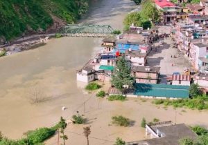
Beyond the headlines of Dharali and Chisoti, remember that the Himalayas’ landslide lakes are ticking time bomb—and our current approach to safety is dangerously outdated.