 Santa was standing on his rooftop in his village during a relentless, pitch-black midnight monsoon downpour.
He was holding a large, soggy paper grid map and a common household flashlight, trying to spot whether the local river basin had breached its banks over the ridge.
Banta walked up the stairs, casually holding a tablet screen that displayed a vibrant, multi-colored live radar map of the entire district, showing exact water flow velocities and structural inundation boundaries in real time.
“Oye, Banta!”
“Help me shine this flashlight toward the northern valley!” Santa shouted, wiping muddy rain out of his beard.
“The village assembly needs a visual status update on the flood line.”
“If I can’t see the water coming through these thick storm clouds, how can I predict where it will hit?”
Banta shook his head, pulling Santa under a dry canvas awning and showing him the glowing tablet.
“Santa-ji, you are trying to fight a 21st-century atmospheric monster using an old battery torch and a paper drawing!”
“You are standing there completely blindfolded!”
Santa pouted, squeezing water out of his map.
“Oye Banta!”
“It’s a standard topographical map!”
“Why rely on a computer screen when my own eyes are the ultimate truth?”
“Because your eyes cannot look through miles of dense, heavy rain clouds at midnight, Santa!” Banta explained.
“According to data from the UNDRR, climate-related disasters have surged dramatically over the last two decades, with floods more than doubling globally!”
“Climate science warns us that for every 1°C of global warming, extreme precipitation events strengthen by about 7%!”
“When a massive cloudburst hits, you cannot wait for the water to touch your boots before you react.”
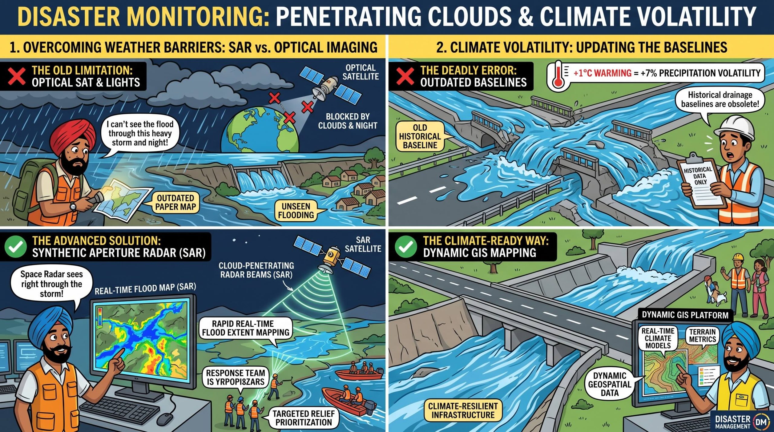
“This tablet is connected to satellite Synthetic Aperture Radar (SAR) imagery.”
“Unlike your eyes or optical cameras, SAR waves effortlessly penetrate through thick cloud cover, dense fog, and midnight storms to map exact flood extents instantly!”
“It gives disaster responders an automated bird’s-eye view, reducing response latency from days to minutes.”
“While you are waiting for the clouds to clear, the satellite has already drawn the exact flood boundary line and prioritized which villages need immediate evacuation rescue!”
Santa stared at the pulsing purple water line on Banta’s tablet, which showed the river breaching a dynamic bend two kilometers away.
He dropped his useless flashlight.
“Oye… so the satellite can see the water moving through the dark while I am still adjusting my lens?”
“Precisely, Santa-ji,” Banta smiled.
“When the climate maximizes hazard velocity, your spatial data infrastructure must run at the speed of light!”
संता – बंता की इस जुगलबन्दी से आज हमने क्या सीखा:-
- सिंथेटिक एपर्चर रडार (SAR) की महत्ता / The Strategic Necessity of Synthetic Aperture Radar (SAR):
- अत्यधिक वर्षा और बादलों के छाए रहने के दौरान सामान्य ऑप्टिकल सैटेलाइट काम नहीं करते। आपदा जोखिम न्यूनीकरण (DRR) के अंतर्गत बादलों को भेदने वाले ‘सिंथेटिक एपर्चर रडार‘ (SAR) डेटा का उपयोग किया जाना चाहिये , ताकि घने बादलों और रात के अंधेरे में भी बाढ़ प्रभावित क्षेत्रों का सटीक मानचित्रण (mapping) किया जा सके / Optical satellite imagery fails during heavy cloud cover and nocturnal events. Disaster Risk Reduction (DRR) frameworks must mandate cloud-penetrating Synthetic Aperture Radar (SAR) telemetry to achieve rapid, real-time flood extent mapping and relief prioritization during extreme monsoon events.
- तापमान वृद्धि और अत्यधिक वर्षा का संबंध / The 7% Precipitation Volatility Vector:
- वायुमंडलीय तापमान में प्रत्येक 1°C की वृद्धि के साथ अत्यधिक वर्षा की तीव्रता लगभग 7% बढ़ जाती है। इसलिए, पारंपरिक जल निकासी डिजाइनों को बदलकर रियल-टाइम सैटेलाइट डेटा और भौगोलिक सूचना प्रणाली (GIS) आधारित मॉडल अपनाना अनिवार्य है / With extreme precipitation intensity expanding by roughly 7% per 1°C of atmospheric warming, historical drainage baselines are obsolete. Spatial data platforms must dynamically couple real-time climate models with terrain infrastructure metrics.
संता – बंता की यह जुगलबन्दी आपको कैसी लगी, कृपया हमें जरुर बताये
व
इस जुगलबन्दी को बेहतर बनाने के लिये अपने सुझाव अवश्य दें।
हमें हमेशा की तरह आपके सुझावों, प्रतिक्रियाओं व कटाक्षो का बेसब्री से इंतजार रहता हैं औरसच मानिये इसी के आधार पर हम अपने आप में, अपनी सोच व रचनात्मकता में सुधार करने कोप्रेरित होते हैं।
सो अच्छा – बुरा जैसा आपको महसूस हुवा हो, कमेंट जरुर करते रहें।
#SyntheticApertureRadar #FloodInundation #GISRiskModeling #UNDRRMetrics#SendaiFramework2026 #SantaBantaStories
Leave a Reply