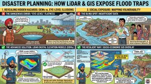
The Sinking Sink: How LiDAR Exposes the Deadly Trap of Flat Real Estate: Santa attempts to pack two hundred family homes into a low-lying urban basin, claiming the ground feels perfectly level under his feet. Banta deploys a high-resolution Digital Elevation Model (DEM) and GIS vulnerability layers to prove why human eyes cannot detect sub-meter flood basins, saving a community from an impending sub-surface disaster.