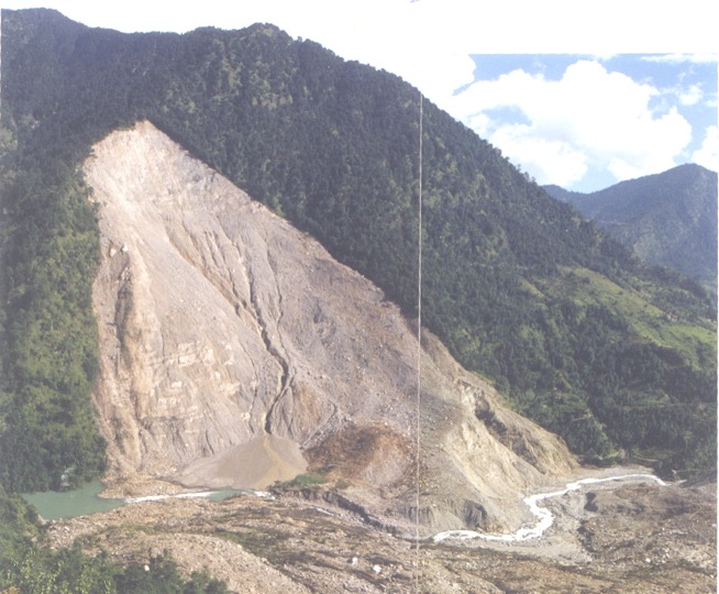
 Uttarakhand, with its breathtaking Himalayan landscapes, is inherently prone to geological hazards, particularly landslides and flash floods. The escalating frequency and intensity of these events, exacerbated by climate change and unsustainable development, pose an existential threat to its communities and infrastructure.
While a wealth of scientific expertise resides within institutions like the Geological Survey of India (GSI), Wadia Institute of Himalayan Geology (WIHG), Indian Institutes of Technology (IIT-R), Central Building Research Institute (CBRI), Indian Institute of Remote Sensing (IIRS), Indian Institute of Soil and Water Conservation (IISWC) and National Institute of Hydrology (NIH), a persistent and complex challenge lies in the effective translation of this knowledge into actionable strategies on the ground.
The current approach to geological hazard management often appears fragmented and reactive, characterised by coordination gaps not just between GSI and state agencies, but across the entire spectrum of scientific, administrative, and local stakeholders.
This fragmented model is simply no longer tenable.
We thus outline a comprehensive blueprint for transforming Uttarakhand into a truly landslide safe state, emphasising a proactive, integrated, and genuinely collaborative model of hazard mitigation that acknowledges the strengths and constraints of all involved parties.
The Coordination Conundrum: Unpacking the Challenges in Geological Hazard Mitigation
Despite decades of experience and numerous studies, the effective mitigation of geological hazards in Uttarakhand remains hampered by several critical coordination failures.
These are not merely one-sided issues but systemic challenges that arise from the inherent complexities of the terrain, the diverse mandates of various agencies, and the practical realities of ground-level operations.
Addressing these systemic issues, without assigning blame, is the crucial first step towards building genuine resilience.
Nuance in Problem Definition: A Shared Understanding Gap
A fundamental challenge often emerges at the very inception of an intervention: the lack of precise understanding and articulation of the geological issues at hand from all sides.
State agencies, facing immediate pressures, may issue requests for interventions without fully grasping the underlying geological complexities, leading to generic demands that scientific bodies find difficult to address with the specificity required for effective solutions.
Conversely, initial appraisals from scientific institutions, while accurate, might not always be framed in terms of immediate, actionable steps or within the practical timelines required by state engineers.
This ambiguity at the problem definition stage can inadvertently derail subsequent efforts, leading to miscommunication and unmet expectations.
The Scope of Scientific Engagement: Mandates and Resources
The involvement of scientific institutions like GSI, WIHG, or IITs is often restricted to quick appraisals, problem identification, and report submission.
While invaluable, this initial assessment frequently lacks a consistent follow-through on remedial actions or the detailed, long-term investigations that complex landslide zones often demand. This limitation can stem from the scientific agencies’ mandates, resource constraints, or the sheer scale of the problem across the state.
Once a report is submitted, the onus often falls entirely on state agencies to interpret and implement recommendations, sometimes without continuous scientific guidance or the necessary technical manpower to fully leverage the insights provided.
The Hindrance of the Blame Game: Eroding Trust
Post-disaster scenarios, unfortunately, too often devolve into a blame game, where various agencies, under immense public and political pressure, point fingers rather than focusing on collaborative solutions. This adversarial environment is deeply counterproductive; it stifles open communication, discourages proactive reporting of challenges, and ultimately, severely hinders collaborative progress.
Fostering a culture of shared responsibility, mutual respect, and learning from past challenges is absolutely essential to move forward.
Fragmented Investigations and Implementation: A Practical Reality
As starkly observed in the Joshimath crisis, geological investigations and subsequent implementation efforts are often conducted without adequate joint planning or mutual consultation among all relevant stakeholders.
This can lead to ineffective or incomplete data collection, such as insufficient drill holes at critical locations or a lack of specific geotechnical tests tailored to implementation needs. When investigations are not collaboratively designed or executed, their objectives are often defeated, rendering effective remediation impossible due to a lack of comprehensive, reliable, and actionable data.
It’s also important to acknowledge that state agencies, operating with limited technical manpower and under immense time pressure (e.g., clearing a blocked road cannot wait for detailed technical inputs), sometimes have to make immediate decisions that may not always align with the ideal, time-consuming detailed investigations preferred by scientific bodies.
Unheeded Scientific Reports: The Implementation Bottleneck
A recurring and deeply concerning issue is that detailed reports and recommendations from scientific institutions – for instance, concerning vulnerable areas like Bahuguna Nagar, Rudraprayag, or Mastaari in Uttarkashi – are submitted, but often no concrete action is taken.
While this might appear as a disregard for scientific advice, it frequently stems from the practical constraints faced by state agencies. These include limitations of technical and other manpower, financial constraints, and complex, time-consuming decision-making processes within the bureaucratic framework.
These invaluable scientific insights, which could safeguard lives and property, inadvertently gather dust, leaving communities perpetually vulnerable to known threats due to an implementation bottleneck.
Information Silos and Lack of Feedback: A Two-Way Street
Once scientific reports are submitted, institutions like GSI are frequently not kept informed about the actions taken, or not taken, by state agencies. This creates information silos, preventing scientific bodies from understanding the practical challenges of implementation, assessing the real-world efficacy of their recommendations, or refining their future advice.
Conversely, state agencies, burdened by immediate operational demands, may struggle to provide timely and detailed feedback on implementation challenges, further perpetuating this communication gap.
Missing Feedback on Warning Systems: The Calibration Challenge
GSI currently provides rainfall threshold-based warnings for certain districts, which are regularly communicated to the Uttarakhand State Disaster Management Authority (USDMA).
However, a critical gap exists in the feedback loop. GSI consistently requests feedback on the ground realities and the impact of these warnings, but this is often not received. It is crucial to appreciate that warning thresholds can only be accurately finetuned with active, real-time feedback from the ground, allowing for calibration based on actual events and local conditions.
Without this vital feedback, the warnings remain less precise and potentially less effective, hindering continuous improvement in early warning systems.
Towards a Proactive Model: The Imperative for Integrated Hazard Management
To overcome these systemic challenges, Uttarakhand must urgently transition from a reactive, fragmented approach to a proactive, integrated, and truly collaborative model for geological hazard management.
This requires fundamental shifts in institutional structures, operational protocols, and inter-agency communication, built on mutual understanding and shared objectives.
The Cornerstone of Collaboration: A Permanent Inter-Agency Technical Working Group (TWG)
The establishment of a Permanent Inter-Agency Technical Working Group (TWG) is proposed as the central mechanism to foster seamless coordination and integrated decision-making. This body would serve as the primary forum for all discussions related to geological hazards, investigations, and remediation, ensuring a truly multi-disciplinary approach.
Composition
The TWG should comprise senior representatives from:
- Geological Survey of India (GSI): Experts in Geology, Geophysics, and Geotechnical Engineering.
- Uttarakhand State Disaster Management Authority (USDMA): The nodal agency for disaster management, bringing in the administrative and coordination perspective.
- Other Scientific Organizations: Representatives from Wadia Institute of Himalayan Geology (WIHG), Indian Institutes of Technology (IIT-R) with relevant expertise, Central Building Research Institute (CBRI), Indian Institute of Remote Sensing (IIRS), and National Institute of Hydrology (NIH), ensuring a broad spectrum of scientific and technical input.
- Urban Local Bodies (ULBs): For urban and peri-urban hazard zones, providing municipal insights.
- Public Works Department (PWD): Responsible for roads and infrastructure, bringing implementation challenges to the table.
- Irrigation Department: For water resource management and river training, crucial for hydrological aspects.
- Forest Department: Critical for slope stability through afforestation and land-use planning.
- Academic Institutions: Relevant universities or research centers with local expertise, fostering long-term research and capacity.
- Local Administration: District Magistrates and other field-level officers, providing invaluable insights into ground realities and immediate operational needs.
Mandate
The TWG’s mandate should be clear and comprehensive:
- To be the primary forum for all discussions related to geological hazards, investigations, and remediation measures, ensuring all voices are heard.
- To meet regularly (e.g., monthly or quarterly, and on an as-needed basis during emergencies) to ensure continuous oversight, rapid response, and sustained dialogue.
Key Functions
The TWG would perform crucial functions to bridge the current gaps:
- Jointly identify and prioritise vulnerable areas based on comprehensive scientific data, local knowledge, and multi-agency risk assessments.
- Review and collaboratively approve proposals for geological investigations, ensuring these are well-defined, meet specific objectives, and are practical for implementation.
- Ensure all relevant stakeholders are involved from the inception of a project, fostering shared ownership, understanding, and realistic expectations.
- Monitor the progress of investigations and remediation measures in real-time, with transparent reporting mechanisms.
- Facilitate seamless knowledge sharing and data exchange among all member agencies, actively breaking down information silos.
Developing Standard Operating Procedures (SOPs) for Hazard Assessment and Remediation
To ensure consistency, clarity, and accountability across all agencies, the TWG should be tasked with jointly drafting and implementing comprehensive Standard Operating Procedures (SOPs) for every stage of hazard assessment and remediation. These SOPs must be developed with a keen understanding of both scientific rigor and practical ground realities.
Key Areas for SOPs
- Requesting Scientific Services: Clear, standardised guidelines on how state agencies should formally request expertise from GSI and other scientific institutions, including the required preliminary information and the expected timelines.
- Defining Scope and Objectives of Geological Investigations: Detailed parameters for investigations, including minimum drill hole depth, type of geotechnical tests required, geophysical survey methods, and expected deliverables, developed with mutual understanding of what is scientifically necessary and practically feasible.
- Sharing Data and Reports: Protocols for timely, standardised, and accessible sharing of raw data, interim reports, and final recommendations across all relevant agencies.
- Streamlining Decision-Making: Clear, mutually agreed-upon processes for collective decision-making regarding the implementation of remedial measures, including defined roles, responsibilities, and realistic timelines that account for bureaucratic processes and ground-level constraints.
- Monitoring and Post-Implementation Assessment: Guidelines for long-term monitoring of implemented solutions and post-implementation assessment to evaluate their effectiveness and inform future strategies.
Mandatory Adherence
These SOPs should be officially adopted by the state government and made mandatory for all involved agencies, ensuring compliance and accountability across the board.
Building Shared Capacity and Knowledge: A Two-Way Learning Process
Effective coordination is not just about meetings and procedures; it’s about building a shared understanding and capability across all agencies and at the community level.
This requires a continuous, two-way learning process.
Joint Training Programs
Scientific institutions (GSI, WIHG, IIT-R, etc.) should conduct regular, tailored training sessions for state agency personnel (engineers, administrators, field staff) on basic geological principles, landslide identification, and the practical interpretation of scientific reports, bridging the technical knowledge gap.
Reverse Training and Feedback
Crucially, state agencies, drawing from their on-ground experience, can provide scientific institutions with invaluable insights into administrative processes, local challenges, ground realities, and the practicalities of implementation.
This reverse training allows scientific bodies to refine their recommendations, making them more implementable and context-specific.
Awareness Campaigns
The TWG should jointly organize awareness campaigns for local communities in vulnerable areas, explaining the risks, the early warning signs, and the proposed mitigation measures in simple, locally relevant language, integrating traditional knowledge where appropriate.
Integrated Project Planning and Execution: From Concept to Implementation
The entire lifecycle of a hazard mitigation project, from initial identification to final implementation, must be integrated and collaborative, acknowledging the practicalities of execution.
Joint Reconnaissance & Problem Definition
Before any investigation or project commences, all relevant scientific and state agencies must conduct joint field visits to clearly define the problem, understand the local context, and set realistic, mutually agreed-upon objectives.
This ensures a shared starting point.
Collaborative Investigation Design
The design of investigations (e.g., number and depth of drill holes, specific geophysical surveys) should be a collaborative effort within the TWG, ensuring the data collected directly serves the remediation objectives and is relevant to the implementation challenges faced by state agencies.
Phased Approvals
Introduce a system of phased approvals where each critical stage (e.g., investigation plan, interim reports, final recommendations, detailed remediation plan) requires official sign-off from all relevant stakeholders within the TWG, ensuring continuous alignment and accountability.
Leveraging Technology: Information Sharing and Data Management Portal
A robust technological backbone is essential for seamless information flow and transparent data management across all agencies.
Centralised Digital Platform
Create a secure, web-based platform where all geological reports, investigation data, remediation plans, and progress updates are uploaded and accessible to authorized personnel from all relevant agencies.
Transparency and Analysis
This platform fosters transparency, ensures scientific bodies are not left in the dark after submitting reports, and allows for historical data analysis to identify trends and improve future interventions.
Geospatial Integration
The platform should integrate with a robust Geographic Information System (GIS) to visualise data geospatially, allowing for better spatial planning, risk mapping, and real-time monitoring.
Beyond Coordination: Broader Strategies for a Landslide-Safe Uttarakhand
While enhanced inter-agency coordination is paramount, achieving comprehensive landslide safety requires a multi-pronged approach that integrates scientific understanding with community engagement, sustainable land-use practices, and a realistic appraisal of ground realities.
Empowering Communities: Recognizing Nature‘s Warning Signs
The local populace, with their intimate knowledge of the terrain, is the first line of defense. Communities must be trained to recognise nature‘s early warning signs of slope instability – ground tilting, cracks, changes in spring discharge.
This requires dedicated, continuous engagement at the grassroots level, building capacity to not only observe but also to promptly report these signs to concerned authorities through established, easy-to-access channels.
Comprehensive Mapping of Debris on Slopes
Given that a significant proportion of landslides involve the movement of unconsolidated material, a detailed, high-resolution mapping of debris on slopes is crucial.
This mapping should assess the volume, type, and stability of these deposits, informing susceptibility assessments and guiding responsible land-use zoning.
Implementing a Scientific and Practical Debris Disposal Policy
The current practice of haphazardly dumping excavation and construction debris along slopes must cease. A sound, scientific, and practically implementable debris disposal policy is urgently needed.
This includes identifying designated, stable disposal sites, mandating proper compaction and stabilisation of disposed material, and developing cost-effective methods for transport and disposal that are feasible for state agencies and contractors.
This will prevent anthropogenic debris from becoming new sources of landslides and reduce riverbed aggradation.
Sustainable Road Construction Practices: Balancing Development and Safety
Road construction, a major landslide trigger in the Himalayas, must adopt ecologically sensitive practices. This includes minimising slope cutting, employing advanced slope stabilisation techniques; e.g., bioengineering, multi-tiered retaining walls, ensuring effective drainage management along road cuts, and careful consideration of geological structures; e.g., avoiding cuts through valley-dipping strata.
The aim should be to balance the developmental need for connectivity with the imperative of slope stability.
Addressing Agriculture Terrace Induced Landslides (ATIL): A State Responsibility
The growing threat from Agriculture Terrace Induced Landslides (ATIL), caused by neglected and barren agricultural terraces, requires proactive state intervention.
As communities cannot be expected to maintain abandoned fields, the state needs to acknowledge this risk and consider programs, through MGNREGA or the State Disaster Mitigation Fund to maintain the retaining walls of these abandoned terraces, particularly those upslope of habitations.
This is a crucial, often overlooked, aspect of risk reduction.
Prioritizing Drainage Management: The Unsung Hero of Stability
Effective drainage management is often overlooked but is absolutely critical in landslide-prone areas.
Given the highly porous nature of landslide debris and intense rainfall, proper surface and subsurface drainage systems must be designed and implemented in all habitations and infrastructure projects to prevent water infiltration and reduce pore water pressure, which are primary factors in slope failure.
Integrating and Validating Traditional Knowledge
The invaluable traditional knowledge of Himalayan communities regarding sustainable living, water management, and slope stabilization must be formally recognised and integrated into modern mitigation strategies.
Research should be actively promoted to scientifically validate and improvise these cost-effective, socially acceptable, and easy-to-maintain solutions that are inherently suited to the Himalayan environment.
Proactive Geological Advice: Before the Crisis Strikes
Geological advice should not be a post-disaster afterthought or sought only when a problem becomes chronic.
It must be sought and integrated proactively at the very planning and design stages of all developmental projects, infrastructure, and settlement expansions.
This ensures that interventions are inherently safe, sustainable, and avoid creating new vulnerabilities, preventing crises rather than just reacting to these.
Setting Realistic Limits to Road Accessibility: A Strategic Choice
Recognizing that road construction is a significant cause of landslides, the state, in open and transparent consultation with local communities, must set realistic limits to road accessibility.
Not every hamlet can or should have direct road connectivity, especially if it compromises slope stability and safety.
Exploring alternative, less impactful transport solutions like ropeways or strengthening traditional pedestrian paths can be part of this strategic choice, prioritising environmental integrity and long-term safety over ubiquitous, potentially hazardous, road access.
Conclusion
Transforming Uttarakhand into a landslide-safe state is an ambitious yet entirely achievable goal.
It demands more than just scientific reports or isolated departmental efforts; it requires a fundamental and profound shift towards integrated governance, truly collaborative action, and a deep, abiding respect for the Himalayan ecosystem.
By establishing robust coordination mechanisms like the Permanent Inter-Agency Technical Working Group, developing clear SOPs that bridge the gap between science and practice, fostering shared capacity through two-way learning, leveraging technology, and integrating broader sustainable practices, Uttarakhand can move from a cycle of disaster and reaction to a future of resilience and sustainable development.
This blueprint offers a balanced, realistic, and actionable path forward, where scientific expertise, administrative will, and invaluable community wisdom converge to safeguard the lives and livelihoods of those who call the majestic Himalayas home.
आज हमने क्या सीखा:-
परम्परागत सुरक्षा उपायों की अनदेखी या उपेक्षा के साथ ही अनियंत्रित व अनियोजित विकास कार्यो ने हिमालय को विभिन्न आपदाओं के प्रति अत्यन्त संवेदनशील बना दिया है, और विशेष रूप से मानसून अवधि में हर साल भू-स्खलन व त्वरित बाढ़ के कारण जन-धन की भारी क्षति होती हैं। फिर समय बीतने के साथ प्रत्यक्ष हो रहे जलवायु परिवर्तन प्रभावों के कारण इन आपदाओं की बारम्बारता व तीक्ष्णता तेजी से बढ़ रही हैं।
हर बड़ी आपदा के बाद प्रायः आरोप-प्रत्यारोप का दौर शुरू हो जाता हैं (जैसा अभी हाल धराली आपदा के बाद भी देखने को मिला) – कहीं वैज्ञानिक संस्थान उनके द्वारा दिये गये सुझावों पर अमल न करने की बात करते हैं, तो साथ ही राज्य सरकार की संस्थाये वैज्ञानिक संस्थाओ द्वारा समय पर सटीक चेतावनी चेतावनी या आंकलन की कमी की बात करती हैं।
साथ ही अन्तरिक्ष व ब्रह्माण्ड की अनेको जानी-अनजानी तकनीकों व विधाओं का उपयोग कर के उत्तराखण्ड को आपदा सुरक्षित बनाने के लिये विभिन्न संस्थाओ के द्वारा बनाये गये परियोजना प्रस्ताव भी समय-समय पर सामने आते ही रहते हैं।
वैसे अगर गौर किया जाये तो भू-स्खलन रोकथाम या फिर न्यूनीकरण के लिये यहाँ, इस राज्य में, ना वैज्ञानिक या तकनीकी ज्ञान की कमी हैं और ना ही इच्छा शाक्ति की – कमी कहीं दिखाई देती है तो संस्थाओ के मध्य संवादहीनता, आपसी सहयोग का आभाव और मिल कर, एकजुट हो कर काम न कर पाने में।
अब उत्तराखण्ड को भू-स्खलन सुरक्षित बनाने का प्राथमिक उत्तरदायित्व राज्य सरकार का है, तो बदलाव की शुरुवात भी उसे ही करनी होगी – एक ऐसी व्यवस्था बनानी होगी जिससे वैज्ञानिक, तकनीकी व अन्य संस्थाओ के मध्य परस्पर विश्वास व संवाद बढ़े, जहाँ हर किसी को अपने व अन्य सभी की भूमिका व उत्तरदायित्वों का स्पष्ट पता हो, जहाँ मिल कर काम करने व आकड़ो या जानकारियों के आदान-प्रदान में कोई झिझक न हो, जहाँ लोगो के परम्परागत ज्ञान का सम्मान हो और उनकी अपेक्षाओं के अनुरूप, उनकी सहमति से योजनाये बनायीं जाये।
हिमालय या फिर उत्तराखण्ड को भू-स्खलन सुरक्षित बनाने का सपना सच में बहुत बढ़ा हैं, पर सच मानिये यह असम्भव भी नहीं हैं।
तो फिर क्यों न आज और अभी से इस सपने को साकार करने की दिशा में काम करना शुरू कर दिया जाये?
हमें हमेशा की तरह आपके सुझावों, प्रतिक्रियाओं व कटाक्षो का बेसब्री से इंतजार रहता हैं और सच मानिये इसी के आधार पर हम अपने आप में, अपनी सोच व रचनात्मकता में सुधार करने को प्रेरित होते हैं।
सो अच्छा – बुरा जैसा आपको महसूस हुवा हो, कमेंट जरुर करते रहें।
Leave a Reply